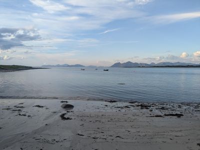
Hiking the extended & athletic Lofoten Long Crossing
The place #
Lofoten is an archipelago in the north of Norway, some 200km above the Arctic Circle. It is warmed by sea currents and Atlantic winds, which make it very cosy relative to its latitude; in the summer, mean daily temperatures are around 12°C. The islands are gorgeous, with sandy beaches, fjords, jagged ridges, a ton of greenery, picturesque fishing villages, and more berries than you could ever wish for. It's also pretty easy to get to, thanks to Norway's excellent transport infrastructure.
In short, Lofoten is a popular holiday destination. The islands are very sparsely populated - permanent population is 25,000 people (20 people per square kilometer), but they're visited by 1 million tourists every year. Most of them, however, travel by car along the crowded international E10 road. This leaves the excellent hiking trails that crisscross the island largely unoccupied, except in the vicinity of villages and parking lots, of which there are not that many.
We travelled to Lofoten in August 2024, with the intention of hiking The Long Crossing, a through-hiking route which traverses the archipelago. We were drawn by the remoteness of the islands and Norway's permissive outdoor access laws. This is a summary of the things that we wish we knew before we started the hike.
(as usual, the we meaning me and my hiking buddy)
The hike - practicalities #
The Long Crossing is a well established trail. It goes from the village of Å in the south to a beach in Delp in the north. The hike is extensively documented at Hiking Lofoten (who invented the route) and Cam Honan's The Hiking Life. We're not going to repeat the information on those websites. We'll focus on our modifications to the hike, and on the information that is not available elsewhere on the internet.
Duration #
The hike is split into 11 sections, but we felt like we could do it in 8-9 days. We had two weeks of holiday, so, to prolong the journey, we modified the trail a bit. We also hiked at a leisurely pace. If it rained in the morning (which was on most days), we stayed in our tent until noon. So close to the North Pole, it never really gets dark in the summer. If you set out late, you can easily hike until midnight. We hiked for 12 days, of which 8.5 was spent on the actual Long Crossing (including a rest day in the middle).
Our (modified) trail #
We hiked the trail south-north, because that fit our ferry and plane schedules better. In addition to the Long Crossing, we decided to start as far south as we could get, and to do as many side trips on the way as possible. Most of our side trips came from the Athletic Trek, another great hike put together by the good folks at Hiking Lofoten.
To go to the southernmost bit, we went from Moskenes to Å, and walked along the Ågvatnet lake, through an unnamed pass, to Gjerdvika bay, and then along the sea to Refsvikhula cave. We would not recommend anyone to do this, for reasons which we describe in the section on Danger.
For the first bit of the crossing proper, we followed the Athletic trek, climbing up Stovla, Moldtinden and Hermansdallstinden. Then, we went off-trail to skip the Forsfjord Ferry.
Bypassing Vindstad ferry #
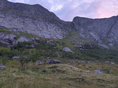
The original trail asks you to take a ferry from Forsfjord to Kjerksfjord. The ferry goes 2-3 times a day, and sometimes doesn't stop where you'd like it to. Cam Hogan's blog post mentions that it's possible to bypass it by walking through a saddle near Helvetestinden. That's what we did. There is a faint, often disappearing trail leading down from the saddle towards Kjerksfjord. It was OK in good weather, but there was strong evidence of rockslides, and the ground was often unstable.
Here, we publish, for the first (to our knowledge) time on the Internet, a GPX file for that section: link. Again - hike at your own risk! Never blindly follow a random stranger's GPX trace (foreshadowing).
After Kjerkfjord, we followed the canonical route, with minor excursions for supplies and small side trips.
Danger #
Overall, we agree with Cam's rating of this hike as moderate-advanced. The level of danger/difficulty increases (in our view) from bearable in most conditions for The Long Crossing, to only safe in good weather for the Athletic Trek, to not safe at all without mountaineering gear for our version.
The Long Crossing #
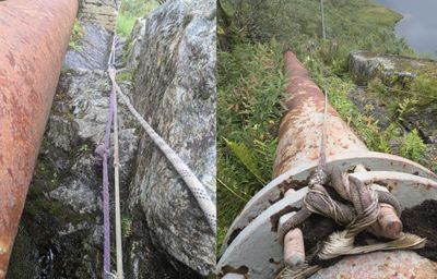
This route is not a good choice for inexperienced hikers. You will find reports on the Internet of people abandoning mid-way after witnessing the sketchier bits; we met people who have turned back during our traverse. Especially worrying are the sketchy ropes used for support in some sections. Here is a photo of a typical case - worn-down dynamic rock climbing rope with exposed core, running over sharp rock without any protection. There is a lot of those on the way.
The Athletic Trek #
Some bits of the Athletic Trek are only safe in good weather, when snow has completely disappeared. Especially ascent and descent from Stovla/Moldtinden feature many exposed slopes with no handholds, where the only thing preventing you from tumbling down the mountain is the friction between your shoes and some rock (we know this is technically true for every hike, but you get the idea).
Going down south #
The most dangerous part of our hike was walking from Å to Gjerdvika bay. We had some extra time, so we could start the hike as far south as possible. We found a trace on AllTrails that suggested that you could walk all the way from Å to Hellsanden, which is the southernmost beach on the island, and we decided to give it a go. We won't link to it here so you don't feel like trying.
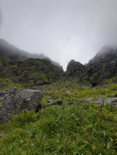
The difficult bit is getting over an unnamed pass on top of the Ågvatnet lake. There is, as far as we could make out, only one chute going up it. It's hard to find, requires crawling under a rock to access, and once you get in there, you realise it's full of sand and scree, and nearly vertical.
The climb on the other side is a bit better, but also almost vertical in places, with nothing but vegetation to hold on to. Once you get down, the walk from Gjerdvika to Refsvikhula is quite nice. However, at some point, you have to go under a cliff leading to Steinberget and, if you're there at the wrong time, you may get cut off by the tide, and forced to camp somewhere you'd rather not (ask us how we know). Finally, the pass at Gongskordet seems to be prone to rockslides, which make it well... unpassable.
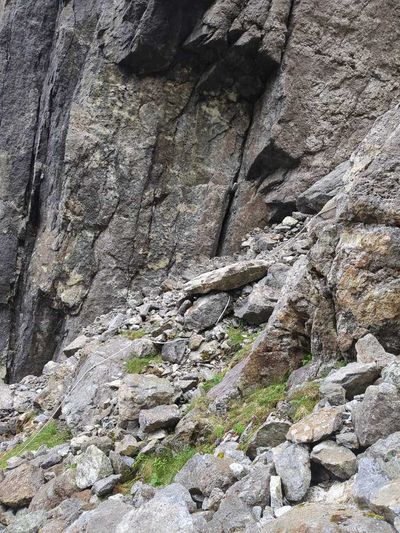
This is the point at which we gave up on Hellsanden. We were very stressed out about getting back to Å, because scrambling down vertical chutes is much more dangerous than scrambling up them. Luckily, we found 40m of sturdy polypropylene rope that was washed up on the beach, and used that to perform a body abseil down the most dangerous bit. Which of course turned out to be just a bit longer than 40m. Do not go there without mountaineering equipment.
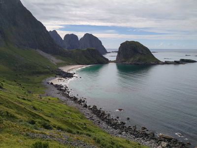
Having said that, the southern bit of the island is decidedly the most beautiful place we saw in Lofoten, if not in our lives. And there is literally no-one there. We feel very privileged that we got to explore it for three days. That photo in the introduction - that's Gjerdvika bay. We put it here again because it's just so pretty.
The typical way to get there is by boat, which we highly recommend.

Accommodation (wild camping) #
Norway is a great place for hiking due to their extensive right-to-roam laws (allemannsretten). You're allowed to walk and camp almost anywhere, so long as you stay 150m away from occupied buildings, and don't stay in one place for more than two nights (source). This is the main reason we came to Lofoten.
We camped throughout the entire journey, except for our zero day, which we spent in the lovely Kræmmervika Rorbuer, a hostel in Ballstad. The hostel is located in an old fishing hut, and the fastest way to get to the grocery store is by rowing their boat. Highly recommended.
It's not easy to find good campsites along the route. The ground tends to be quite boggy, and it's rarely flat. Camping on the beach can be difficult due to the wind. We were glad we brought a footprint for our ultralight tent.
Weather #
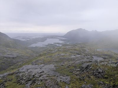
Hiking in Lofoten is, in many ways, similar to hiking in Scotland. It's beautiful. There are barely any people. You can camp anywhere. But it rains, a lot; it rained on 10 out of 12 days we spent there. And it's pretty windy. We had to abort a beautiful ridge walk from Hestræva to Napp, because it was impossible to walk in a straight line. Bring good rain gear, and have a system to protect your stuff from getting wet. We used a multitude of plastic bags, which worked great.
On a positive note - we encountered almost no mosquitoes on the trail!
Travel #
We flew to Bodø, and then took the ferry to Moskenes. On the way back, we took a bus from Delp to Svolvær, and then a fast ferry back to Bodø. We booked the fast ferry in advance, for the slow ferry we just turned up a little earlier.
As we said in the introduction, Norwegian infrastructure is great. It took us 14 hours, all in, from our doorstep in Berlin, to the first campsite, including a one hour hike up the first mountain. The Bodø - Moskenes ferry is free, and the bus driver on the way back from Delp drove us for an extra 30 minutes all the way to Svolvær, just so we didn't have to wait in the rain for the next bus.
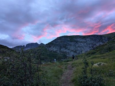
The trail has short sections on which you have to travel by car (when you're going through tunnels), and longer sections which go along the road. Including the busy, loud E10. We don't like walking along the road, so we hitch-hiked those parts. It was very easy to get a ride; the longest we needed to wait was 30 minutes, and that was on a tiny road around Horn, with barely any cars passing.
Food & veganism #
Lofoten is not a great place to be vegan. In the few restaurants that we visited, people's response was Vegan? What's that?. If you're less picky about your diet, you can resupply in the local shops and cafes, but we brought all of our food with us.
We subsided on a mix of:
- fancy ramen noodles with cold-soaked soy strips
- vegan bolognese with pea & jackfruit mince and mashed potatoes
- peanut butter noodles
- thai curry with cous-cous and outrageously expensive red peppers bought at resupply points
Of course, when you hike, most of your calories actually come from snacks, so that bit of the menu is irrelevant from survival perspective. However, a nice, warm evening meal is very important for morale. Following GearSkeptic's awesome 6 hour youtube series on backpacking nutrition, we managed to get a respectable 4.9kcal/g (139 kcal/oz) out of our food. This allowed us to comfortably carry 6 days' worth at a time. We brought all our rations on the plane, and sent half of them from Bodø to Ramberg in a parcel. The Norwegian postal system seems to be very robust, even in the far north - the postal workers were confused when we asked if our parcel would reach its destination within the promised 5 days. It was a bit difficult to find someone to accept a parcel in Ramberg. We spent two hours calling every Ramberg phone number that we could find until someone agreed to take it. If you'd like to do the same - don't give up!
A highlight of our food experience was Maloca - a vegan cafe in Bodø. A bit too hippie and spiritual for our tastes, but they do have amazing cake and coffee, which are, again important for morale. Other than that, the few times that we ate out, we were confined to that all-time vegan travel favourite - French fries.
Conclusions #
We'll leave you with an anecdote. Norwegians really love cloud berries, which are sort of golden raspberries that have the taste and texture of a tart quince jam. They say that once you find a patch, you keep the location secret from everyone except your best friends. Well, this trail is literally covered in cloud berries, from start to finish. So I guess we're friends now. Enjoy!
